El Everest creció casi un metro, según la nueva medición hecha por Nepal y China
El ‘techo del mundo’ se yergue a 8.848,86 metros sobre el nivel del mar
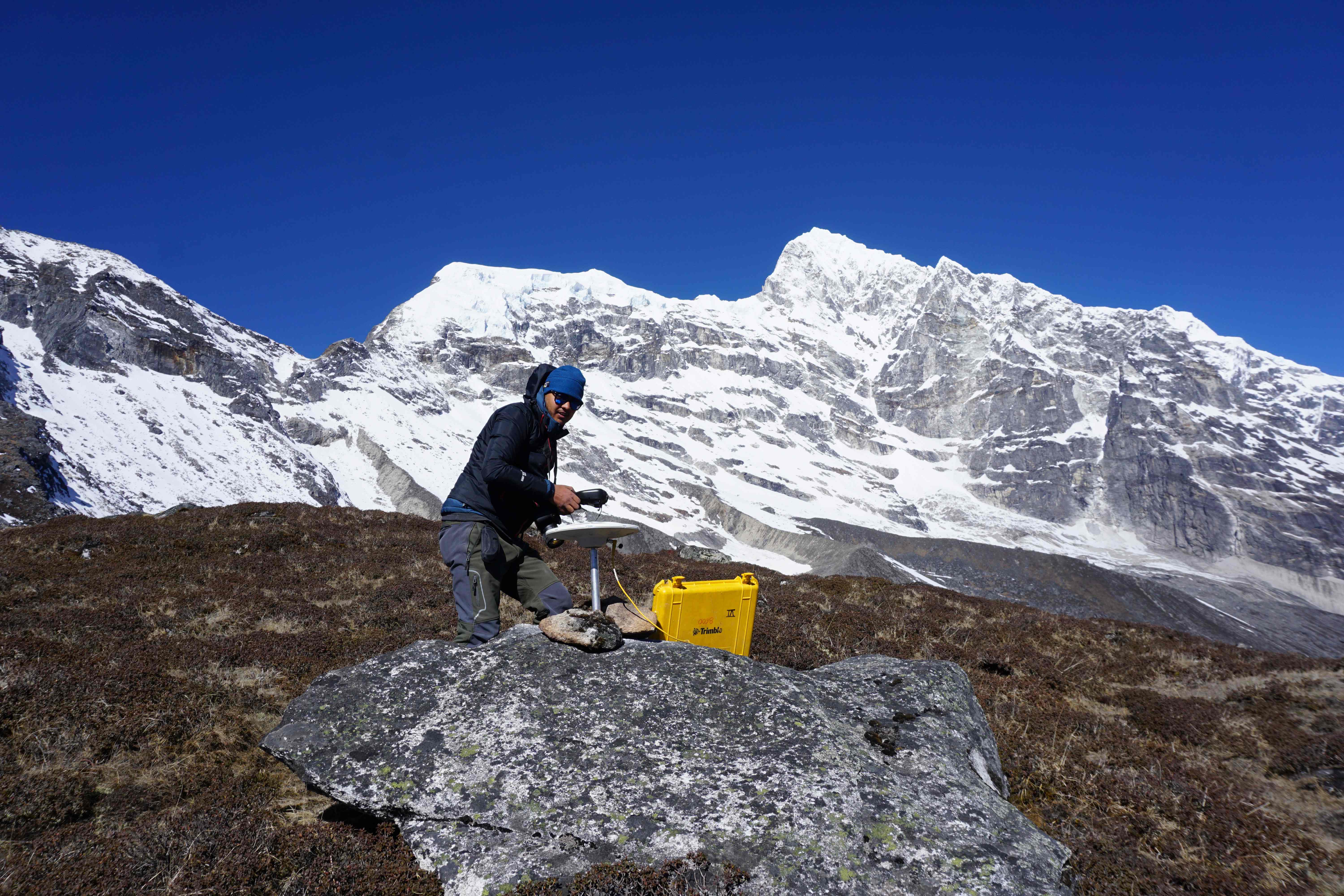
In this undated handout photo released by the Survey Department, Nepal on December 1, 2020 a team member places a Global Navigation Satellite System (GNSS) receiver after drilling it on a rock during Mount Everest height measurements. - The highest point on Earth got a bit higher on December 8 as China and Nepal finally agreed on a precise elevation for Mount Everest after decades of debate. The agreed height unveiled at a joint news conference in Kathmandu of 8,848.86 metres (29,031 feet) was 86 centimetres (2.8 feet) higher than the measurement previously recognised by Nepal, and more than four metres above China's official figure. (Photo by - / Survey Department, Nepal / AFP) / -----EDITORS NOTE --- RESTRICTED TO EDITORIAL USE - MANDATORY CREDIT "AFP PHOTO /Survey Department, Nepal" - NO MARKETING - NO ADVERTISING CAMPAIGNS - DISTRIBUTED AS A SERVICE TO CLIENTS -
AFP
Un integrante de un equipo nepalí instaló un receptor del Sistema de Navegación Global por Satélite (GNSS) después de perforar en la roca mientras se llevaban a cabo las mediciones de la altura del monte Everest. AFP Un integrante de un equipo nepalí instaló un receptor del Sistema de Navegación Global por Satélite (GNSS) después de perforar en la roca mientras se llevaban a cabo las mediciones de la altura del monte Everest. AFP (-/AFP)
Katmandú. China y Nepal acordaron finalmente la altura de la cima del Everest, la montaña mas alta del mundo, que aumentó casi un metro y quedó fijada en 8.848,86 metros sobre el nivel del mar, se anunció en una conferencia de prensa conjunta.
La altura acordada del "techo del mundo" gana así 86 centímetros con respecto a la medida previamente reconocida por Nepal, y más de cuatro metros comparados con la altitud medida anteriormente por China.
Este diferencial se debía al hecho de que China medía la base rocosa de la cumbre y no su capa de nieve, que ahora sí se tiene en cuenta.
Nepal decidió llevar a cabo su primer estudio por su cuenta tras recibir información que sugería que los movimientos de las placas tectónicas, incluido un fuerte terremoto en el 2015, podrían haber alterado su altura.
El Everest tiene nueva altura
Unos 300 especialistas nepaleses participaron en el estudio, algunos a pie y otros en helicópteros, para llegar a las estaciones de reunión de datos.
En la primavera pasada, expertos y escaladores nepaleses, con más de 40 kilos de equipo, incluido un receptor de navegación satelital realizaron dos horas de mediciones en la cima.
"La ascensión del Everest en sí misma ya es una tarea exigente, pero además tuvimos que medir", dijo a AFP Khim Lal Gautam, un responsable del servicio de topografía, que incluso perdió un dedo del pie debido a una congelación.
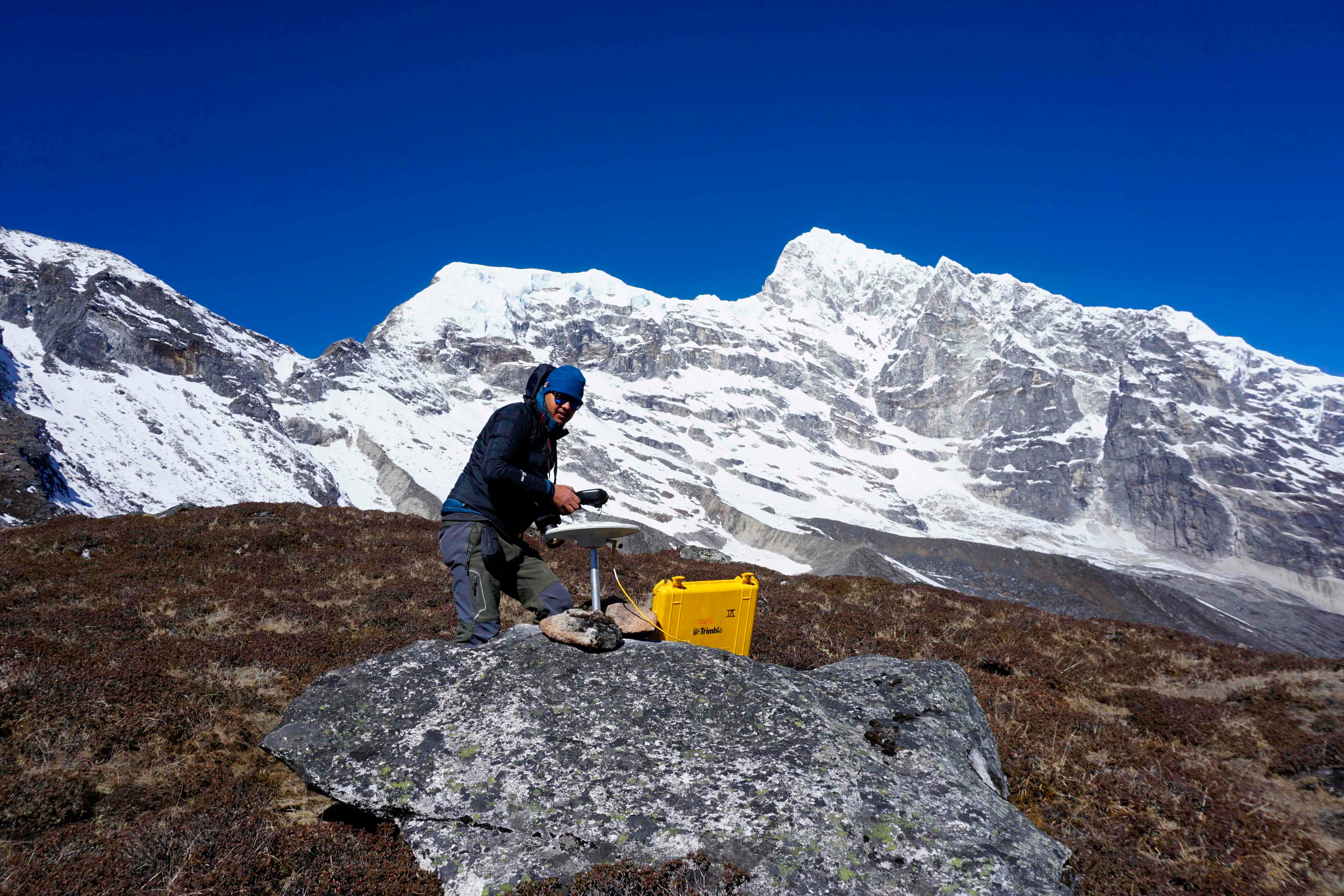
Un miembro de unequipo científico nepalí capturó datos con un receptor del Sistema de Navegación Global por Satélite (GNSS) durante las mediciones de altura del Monte Everest. AFP Un miembro de unequipo científico nepalí capturó datos con un receptor del Sistema de Navegación Global por Satélite (GNSS) durante las mediciones de altura del Monte Everest. AFP (-/AFP)
En el verano una expedición china ascendió a su vez, beneficiándose de condiciones meteorológicas más benignas y de la calma reinante en las alturas del Everest, cuyos accesos a escaladores estaban cerrados debido a la pandemia de covid-19.
Según Dang Yamin, un experto de la Oficina Nacional de Estudios y Cartografía, entrevistado por el canal de televisión estatal chino CCTV, la altitud convenida es un valor medio entre los datos de Nepal y los de China, de conformidad con los métodos científicos.
La altitud del Everest había sido calculada por primera vez, a 8.840 metros, en 1856, por geógrafos del imperio británico, que recurrieron a la trigonometría desde las llanuras indias a centenares de kilómetros de la cumbre.
Después de que Edmund Hillary y su guía sherpa Tenzing Norgay alcanzaran la cima del Everest el 29 de mayo de 1953, un estudio indio había reajustado la altitud a 8.848 metros. Esta medida había sido ampliamente aceptada.
En 1999, la National Geographic Society de Estados Unidos había llegado a la conclusión de que la montaña alcanzaba los 8.850 metros, lo que Nepal nunca reconoció oficialmente.
Mientras tanto, China llevó a cabo sus propios estudios y, en el 2005, anunció la medida de 8.844,43 metros, provocando una disputa con Nepal.
Esta no se resolvió hasta el 2010, cuando Katmandú y Pekín admitieron que la variación entre sus medidas respectivas se debía a que uno consideraba la nieve acumulada en la cumbre y el otro no.
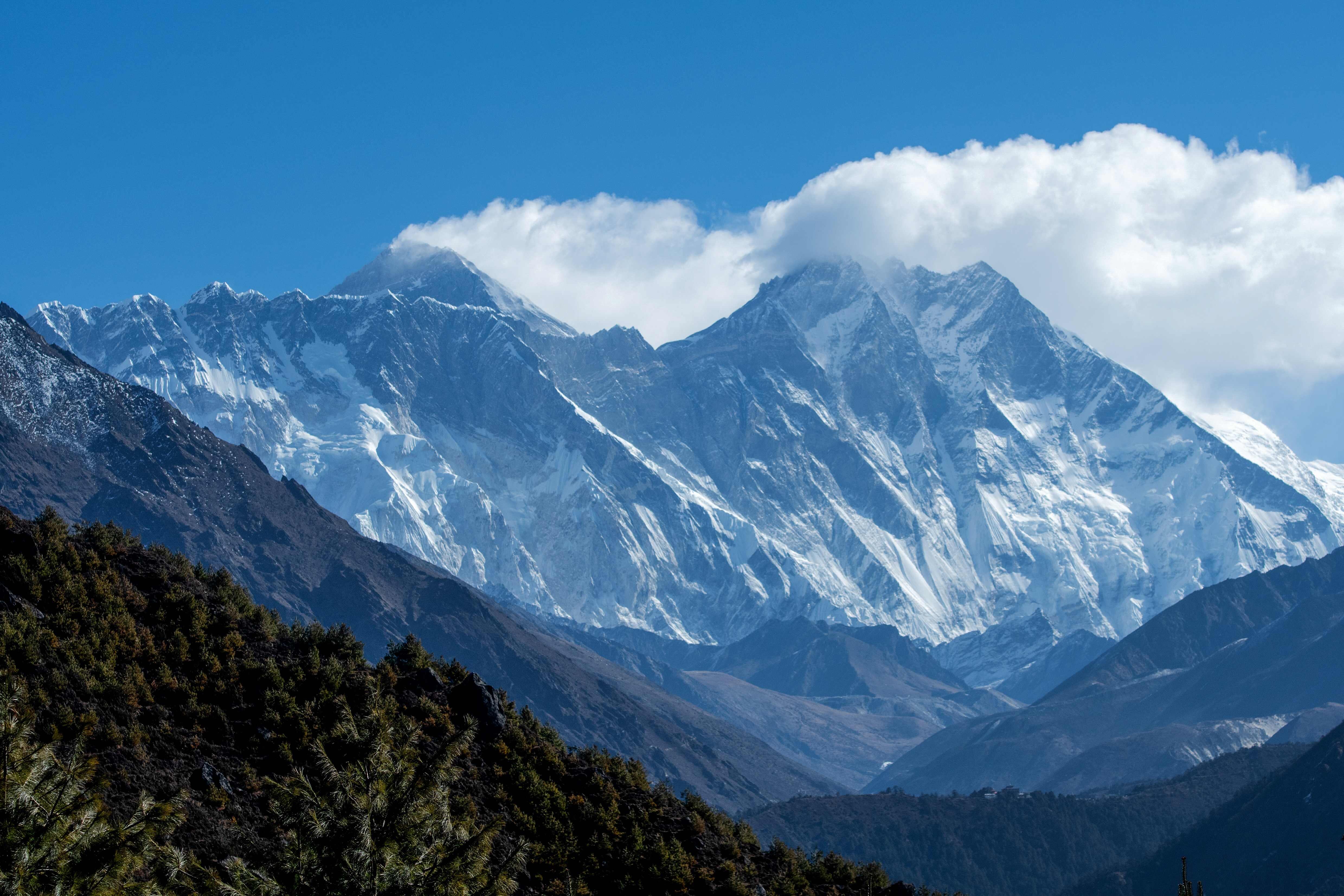
El monte Everest (centro, izquierda) y otras montañas vistas desde Namche Bazar, a 140 kilómetros al noreste de Katmandú. AFP El monte Everest (centro, izquierda) y otras montañas vistas desde Namche Bazar, a 140 kilómetros al noreste de Katmandú. AFP (PRAKASH MATHEMA/AFP)